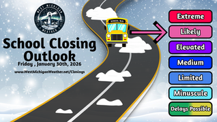
School Closing Outlook For Friday 02/06/2026
- Jonah Drake (Owner & Co-Founder)

- 5 days ago
- 2 min read
Day 1 School Closing Outlook Results
Forecast Results Issued: Friday, February 6, 2026, 9:00 AM
Special Note: We are aware that some schools were closed today that are not reflected on this map. These additional closures were either scheduled (mid-winter break) or were for non-weather-related reasons (such as illness) and thus would not be reflected on this map.
We will just be honest with you guys - we were off on this one.
School closures and delays were much more widespread than what our “Minuscule” risk forecast would indicate. One big miss on our end, in particular, was the US-127 corridor south of Ithaca, where many schools opted to close for the day due to weather conditions, and where we did not have a risk outlined.
There were also several delayed starts down in Berrien and Cass counties this morning, which we also did not have in a risk zone. While there were also several schools closed within our Minuscule risk zone, there are more closures than we like to see for a Minuscule risk verification.
As mentioned in the outlook, confidence was very poor due to the difficulty of accurately predicting if and where freezing drizzle would develop. The snow this morning also hit a bit earlier and impacted road conditions more than anticipated, which was also poorly handled by our interpretation of the computer models.

Day 1 School Closing Outlook
Forecast Valid: Friday, February 06, 2026
Forecast Issued: Thursday, February 05, 2026, 4:13 PM
Forecasters: Jonah Drake and Jacob Melton

Summary:
There is a “Minuscule” risk (level 1/6) for school closures or delays on Friday. We think these are pretty unlikely; however, an extremely isolated closing or delay can’t be entirely ruled out as a round of snow, gusty winds, and freezing drizzle works its way through the area.
Discussion:
As aforementioned, school closings and delays aren’t impossible on Friday morning as snow, gusty winds, and freezing drizzle impact that area this evening and overnight tonight.
There is a Winter Weather Advisory in effect for much of our northwestern area until 1:00 PM tomorrow.

Despite the advisory, however, we believe that limiting factors, including the number of snow days that districts have already had, very light snowfall amounts, very low chances for winds to cause power outages, and the difficulty of accurately predicting freezing drizzle will be extremely limiting to the overall risk level of this forecast and the confidence in the overall forecast as a whole.
Any areas that do see a decent push of snow, gusty winds, or freezing drizzle tonight may see a couple of isolated closures or delays on Friday morning, but it is next to impossible for us to accurately highlight these areas with any reliability. Therefore, we have blanketed much of the area north and west of a St. Joseph to Kalamazoo to Alma line with a level 1 of 6 “Minuscule” risk, which indicates that 0-3 schools may be closed or delayed within this area.
Graphical Forecast:


Comments